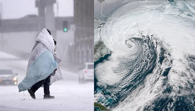
An urgent weather warning has been issued for eight East Coast states as a powerful "bomb cyclone" is expected to bring hurricane-like conditions to the region. Meteorologists are predicting that states from Maine to New York will experience the worst effects starting Wednesday evening, including dangerous flooding and widespread power outages.
Major cities like Philadelphia, New York City, Boston, Providence, and Hartford could face significant flooding, including urban and small stream flooding. Higher elevations in Vermont, New Hampshire, and Maine, where there's several inches of snow on the ground, are at even greater risk. Rapid snowmelt could add to storm runoff, potentially causing life-threatening floods.
The National Weather Service (NWS) has issued high-wind warnings for Long Island, New York, and parts of Connecticut from noon to 10 p.m. ET on Wednesday, with winds of 25 to 35 mph and gusts up to 60 mph. Warnings have also been issued for parts of Maine from 7 p.m. Wednesday to 6 a.m. Thursday, and for eastern Massachusetts and Rhode Island from 3 p.m. Wednesday to 1 a.m. Thursday.
Damaging winds are expected to knock down trees and power lines, causing widespread outages. Travel will be dangerous, especially for tall vehicles. The NWS advises staying on the lower floors of homes during the windstorm, avoiding windows, and watching out for falling debris.
The storm has already impacted the southeastern U.S., bringing heavy rain and even tornado warnings earlier this week. As it moves north, it will reorganize along the mid-Atlantic coast on Wednesday, rapidly intensifying through a process called "bombogenesis." This will strengthen the storm, with rain expected to total up to eight inches in the Northeast and six inches in the Southeast. New England, particularly along the coast, will experience the heaviest impact.
In Maine, where some schools delayed opening due to early snow, the western part of the state is preparing for freezing rain, heavy downpours, and high winds. Temperatures are expected to rise, increasing the risk of flash flooding. Vermont is also on flood watch from Wednesday afternoon to Thursday morning, with the capital, Montpelier, preparing for mild flooding. Officials are advising residents to elevate items in basements and low-lying areas.
This storm is similar to one that hit the West Coast in November, causing fatalities, power outages, and widespread damage. If this storm follows a similar path, the East Coast could be in for severe weather this week.

.png)
